A Short Road Trip From Town
Big Creek Golf Club (no tee time required)
No Tee Time required! Discover this great 9-hole golf course which offers the unexpected! This challenging course offers, several elevation changes, watered greens and tees, longer, more open fairways and native rough. Great practice facility with a large driving range and putting green. You might be surprised to see such a great golf course here on the prairie.
24073 J Road
Take Exit 127 from I-70 and travel South on Hwy 283 to J Road
Club House Phone 785-743-2617
Maintenance Shop Phone 785-743-2420


Shiloh Vineyard & Winery
Shiloh Vineyard & Winery is a small, family-owned winery founded in 2008. You’ll find premium wine made from fruit grown there in the vineyard. You’ll fall in love with the wine, the location and the open prairie. They feature a catch and release fishing pond, and are a Harvest Host ® .
Shiloh is also an event venue for your celebrations. Located at I-70 Exit 120. Head South on the dirt road to Road M. Turn west at Road M and you can’t miss it. You won’t want to miss it!
16079 M. Road, WaKeeney
785-743-2152
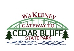
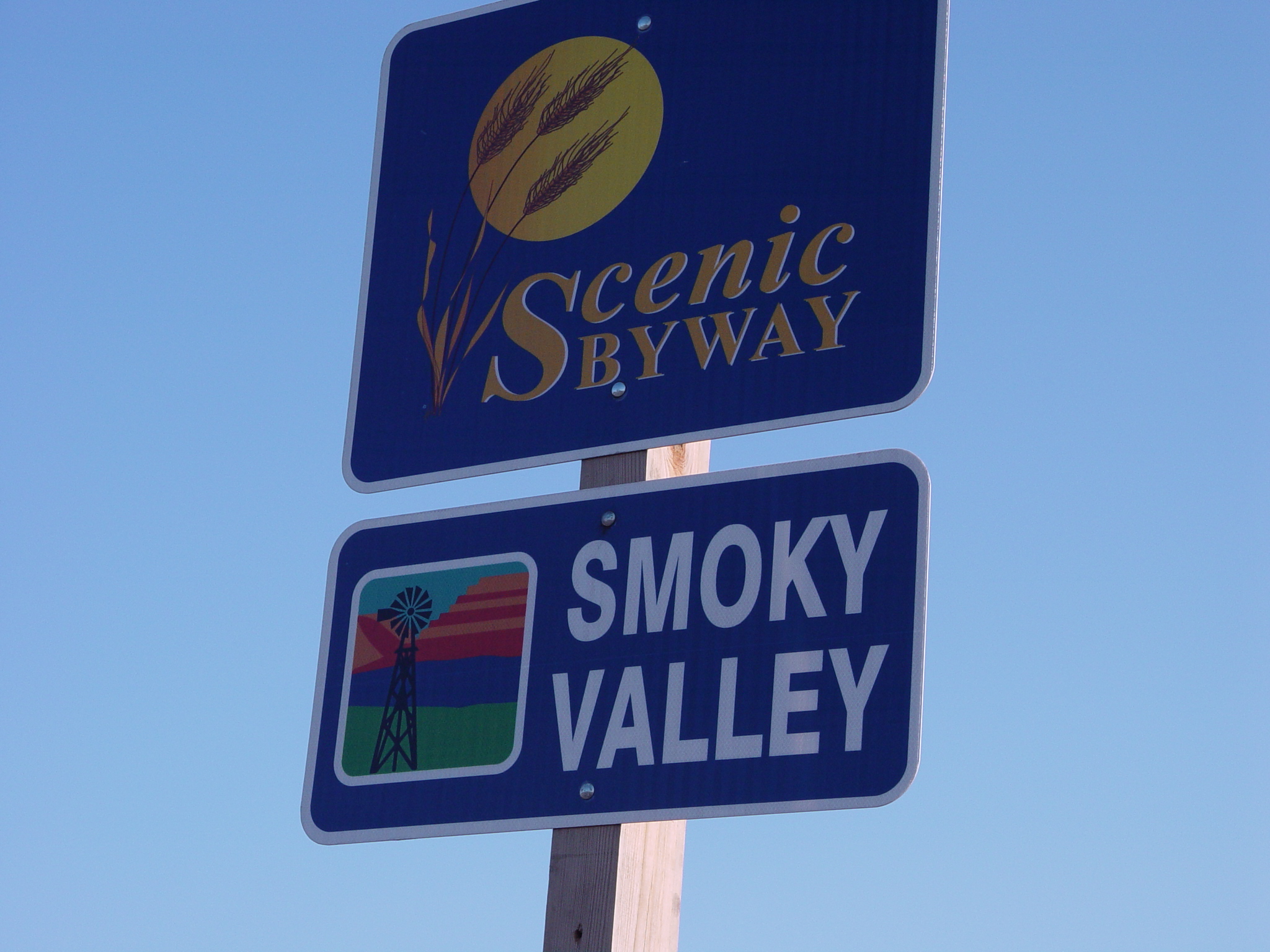
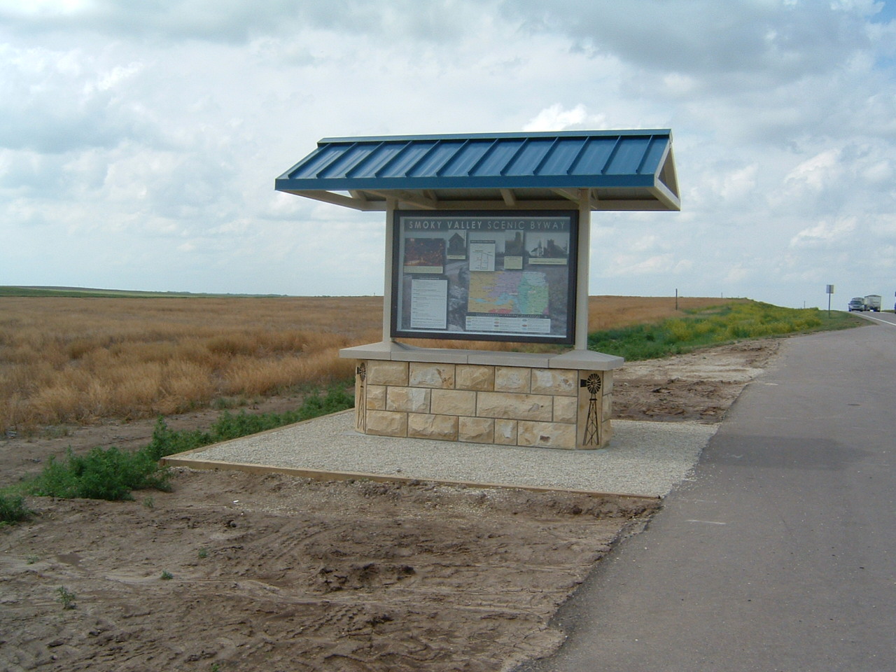
Smoky Valley Scenic Byway
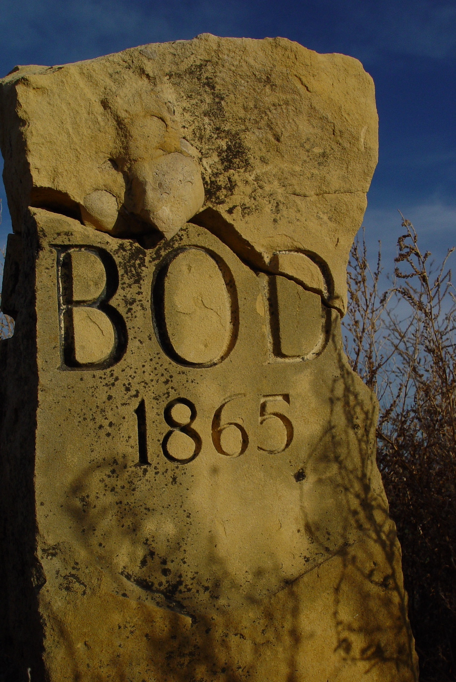
The byway offers an abundance of wildflowers in season and endless sunrises and sunsets to its visitors. This 60-mile scenic drive passes through the Smoky Hill River Valley giving it its name. This byway is unique in that it loops from I-70 Exit 135 back to I-70 Exit 127. This scenic byway will bring you sites of the Smoky Hills, given their name for the hazy, blue-gray appearance at sunrise and sunset. The byway is filled with abundant history of the westward movement; in particular, the Butterfield Overland Despatch. This wagon trail was established in 1865 from Atchison/Fort Leavenworth, KS to Denver, CO. The BOD was the shortest route to the Rocky Mountains and the gold, but not always the safest route. The Smoky Hill Trail Association was formed in 2007 to promote interest in the trail and preserve its history. Read more about the Smoky Hill Trail.
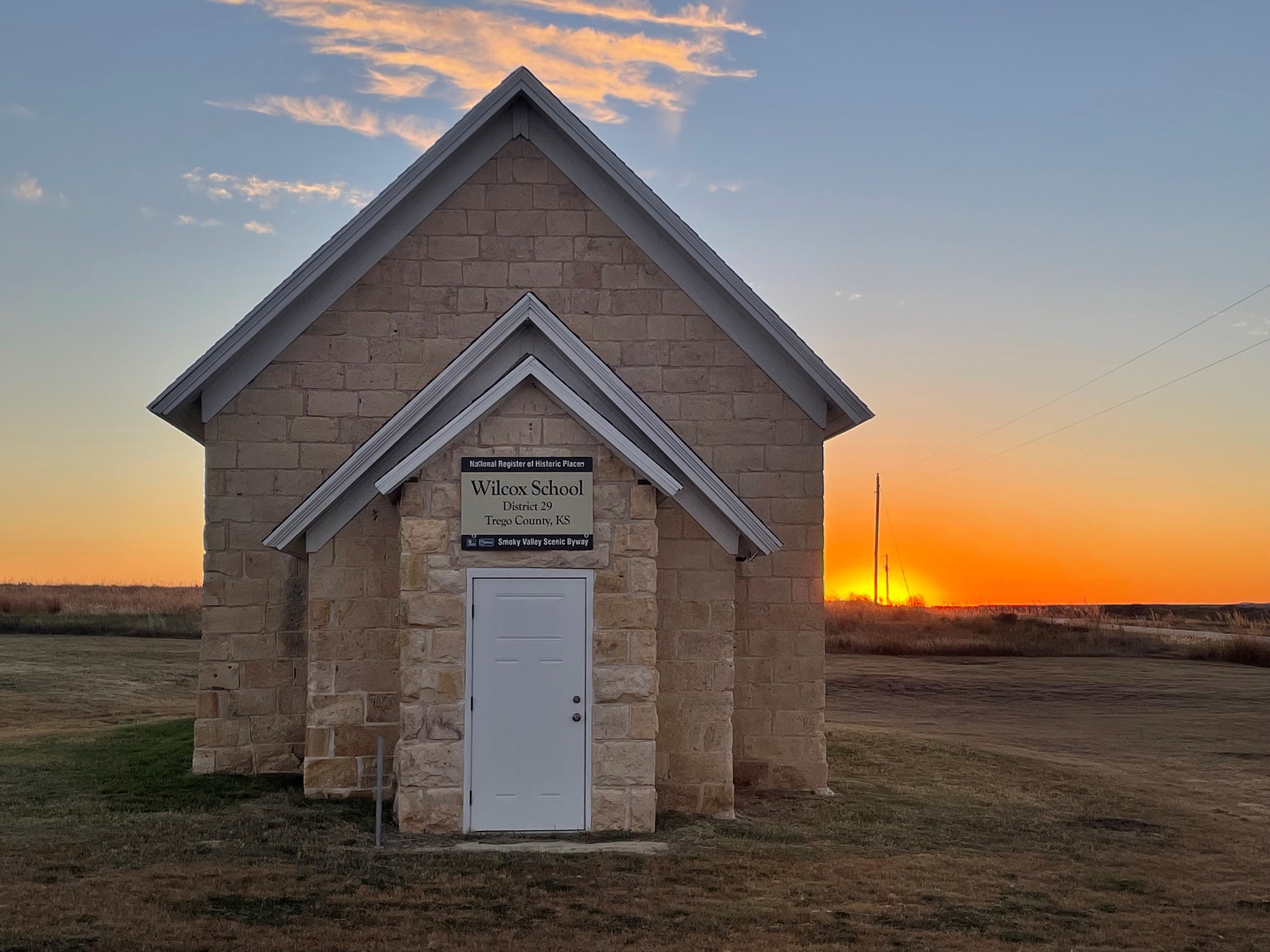
In addition to its native wildflowers and grasses, the byway exhibits beautiful scenery of Cedar Bluff State Park & Reservoir and much more. Along this route you can also find history at Zion Lutheran Church, The Wilcox School House, Emanuel Lutheran Church, and Threshing Machine Canyon.

Threshing Machine Canyon
Cedar Bluff State Park is the gateway to a canyon noted for its historic significance. Threshing Machine Canyon, accessible by a road northwest of the mark, was the site of a station on Butterfield’s Overland Despatch (BOD) or the Smoky Hill Trail, called Bluffton Station. In 1867, a wagon train transporting a threshing machine to Brigham Young in Salt Lake City camped for the night beneath a bluff overlooking the canyon floor. A group of Native Americans attacked the encampment, killed the travelers and set the threshing machine on fire. Remains of the old burned machine could be seen for years. Today, you can see the charred pieces of the Threshing Machine at the Trego County Historical Museum.
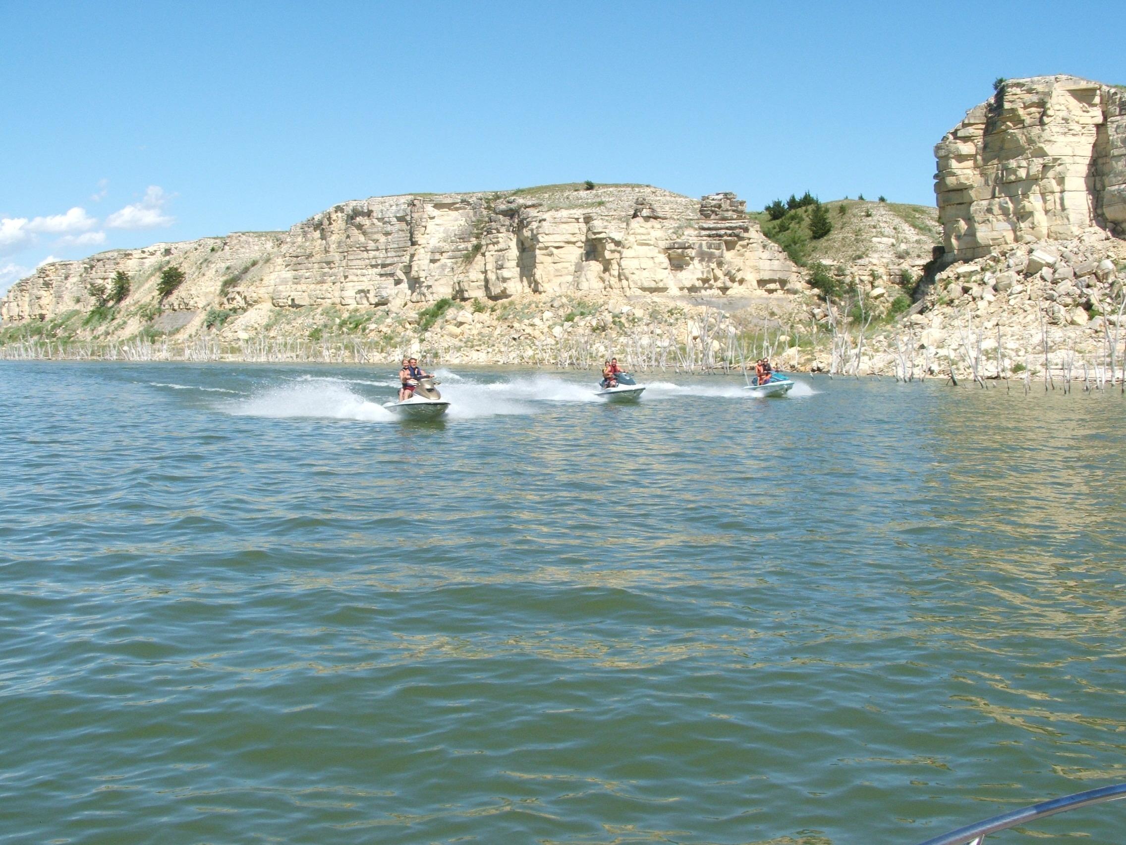
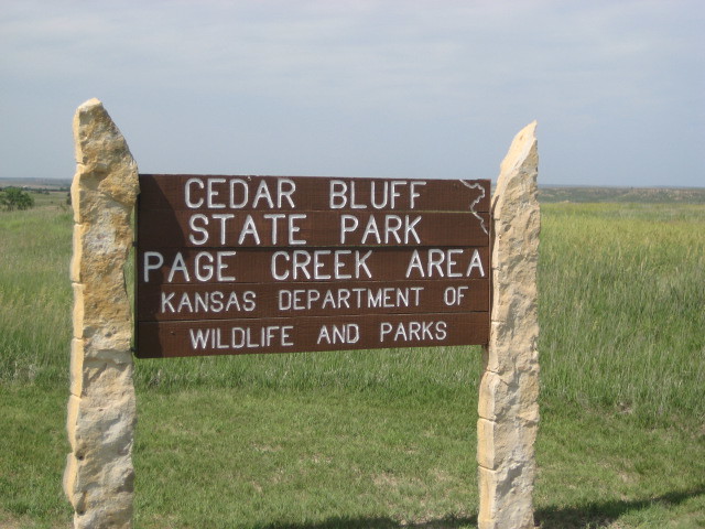
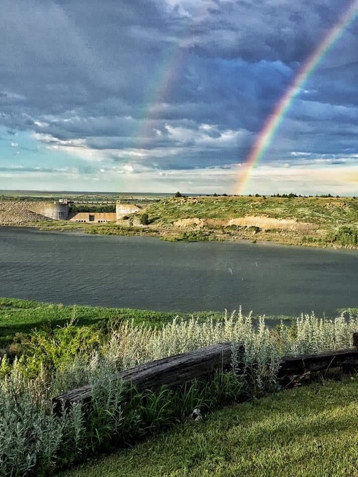
Cedar Bluff Reservoir, State Park & Wildlife Area
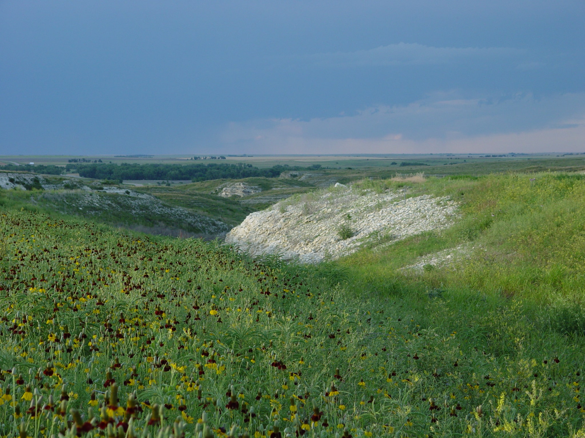
Discover the 6,000-acre lake and almost 10,000 acres of adjacent wildlife area. Named for the 150-foot tall cedar-covered limestone bluffs rising along the south side of the reservoir, the park provides a stunning rustic setting for park visitors. Fishermen are drawn to Cedar Bluff’s angling opportunities, especially wiper, crappie, white and largemouth bass.
The Park also offers an excellent base camp for hunters and year-round explorers. Cedar Bluff State Park is divided into two unique areas along the shorelines of Cedar Bluff Reservoir. The Bluffton Area on the north shore is quite developed with everything the outdoor enthusiast needs. The south side is known as the Page Creek Area and is nearly 500 acres in size. The area includes 121 utility site hookups and rentable cabins. Hunters will delight in upland birds, water fowl, and deer. Nature enthusiasts can enjoy the hiking and biking trails.
https://www.ksoutdoors.gov/about-kdwp/where-we-work/state-parks/cedar-bluff

Agave Ridge & Butterfield Hiking Trails
Agave Ridge Trail is a 5-mile trail on the south side of Cedar Bluff State Park. This trail is mostly flat, but at times has small steep hills. There are many bluffs to gaze upon all along the trail. There is also a small wooded area to enjoy the wildlife.
Butterfield Hiking Trail is a 1.25-mile trail on the north side of Cedar Bluff State Park.
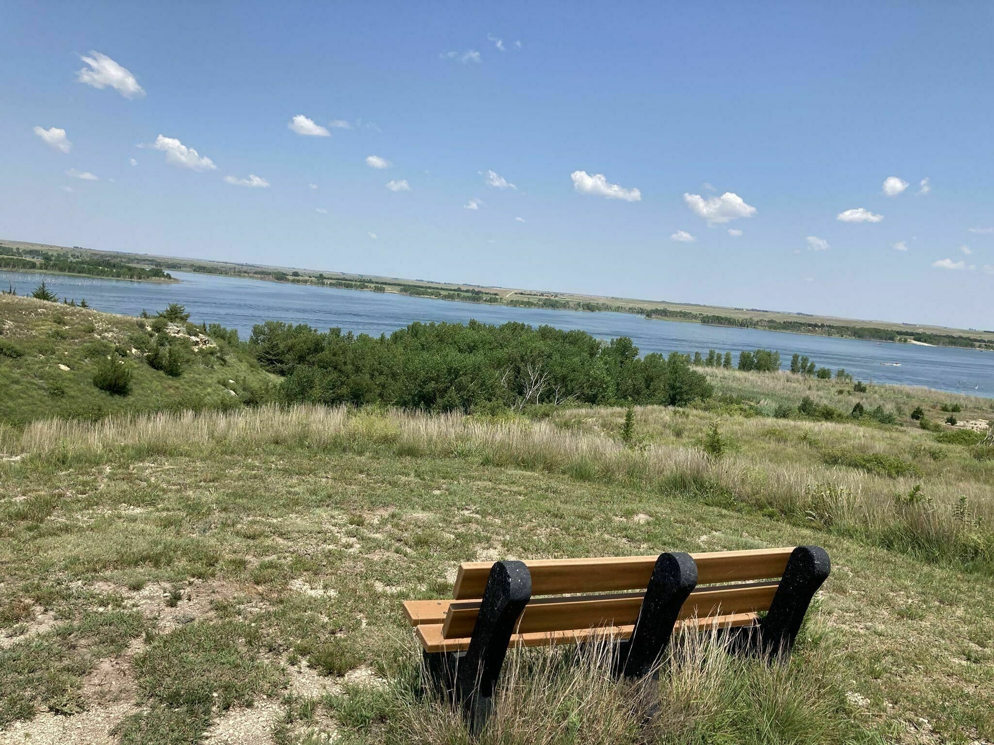
Cedar Bluff Scenic Overlook
Cedar Bluff derives its name from the ½ mile of 100-foot chalk limestone bluffs rising along the south side of the reservoir. The bluffs are covered with native juniper trees which were misidentified by the early settlers as cedar trees. A rugged gravel road leads to the top of the bluffs and the scenic overlook. The scenic overlook provides a stunning, rustic setting for visitors. It offers a spectacular view of the area and is an ideal location to view area wildlife. The bluffs are located 4.2 miles east of Hwy 283 on Trego County Road AA. Turn north on Trego County Road 290 and the follow the signs to the top.


Castle Rock & Badlands
These rock formations were formed over 80 million years ago when Kansas was part of a vast inland sea stretching from the Gulf of Mexico to Alaska. Over time the calcium built up on the floor of the sea and produced a soft sedimentary layer hundreds of feet thick known as the Niobrara Chalk. Castle Rock and the badlands are not so much a hiking trail as an exploration site. Located 12.4 miles south of Collyer (I-70 Exit 115) on Banner Road (Road 130) and 2.8 miles west on Road U (Gove County Road K).